


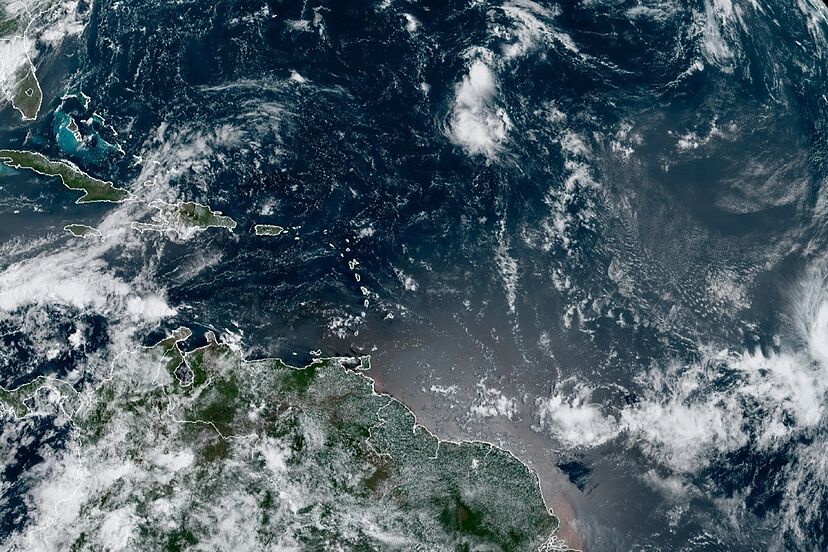
Havana, Sept 22 (ACN) The Cuban Meteorology Institute is closely following the development of an large area of thunderstorms and heavy rains in the south-eastern Caribbean with high probabilities to turned into a tropical depression over the next 48 hours.
The disturbance, moving west-northwest, is located north of Venezuela, the Dutch Antilles and part of the Lesser Antilles and it’s linked to an active tropical wave.
Given local conditions conducive to its development, the phenomenon could rapidly become a tropical cyclone as it moves northwestwards.
Spaghetti models show a possible approach of the storm towards the western Caribbean including the western and central portions of the island of Cuba all the way west to reach the Yucatan peninsula next week.
This system could be reaching the areas south of Cuba, west of Jamaica and northeast of Nicaragua on Sunday evening.
New advisories by the Cuban Meteorology Institute will be issued on Friday.
Disturbance in Eastern Caribbean May Turn Tropical Depression
Nos reservamos el derecho de no publicar los comentario que incumplan con las normas de este sitio