


 HAVANA, Cuba, Aug 15 (ACN) The marked cyclonic tranquility prevailing in the tropical Atlantic and the Caribbean is due to the considerable presence of dust clouds from the Sahara over this geographical area, according to information published in Granma newspaper.
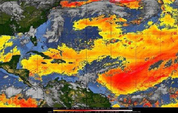
PhD Eugenio Mojena López, advisor to the Center for Forecasts of the Institute of Meteorology, indicated that these clouds provide very hot and dry air, with minimum values of relative humidity, a condition that significantly inhibits the emergence and intensification of tropical cyclones.
Dust clouds increase the vertical shear of the wind in the upper layers of the atmosphere, a factor that prevents any developing tropical system from concentrating the energy required for its formation and gradual strengthening, he said.
He announced that in July and so far in August there was abundant dust from the Sahara in the area between 10 and 20 degrees north latitude, and 20 and 60 degrees west longitude (the area of maximum cyclonic activity in the tropical Atlantic), something that has been observed frequently in recent times.
But in the next few days its influence must begin to gradually diminish in all our geographical area of interest, which also includes the Gulf of Mexico and the Caribbean Sea, therefore, the prevailing "cyclonic calm" may end.
To date, only two named organisms have been formed: subtropical storm Andrea in May (before the official start of the season), and tropical storm Barry in July, which reached the hurricane category shortly before entering the coast of the North American state of Louisiana.
Nos reservamos el derecho de no publicar los comentario que incumplan con las normas de este sitio